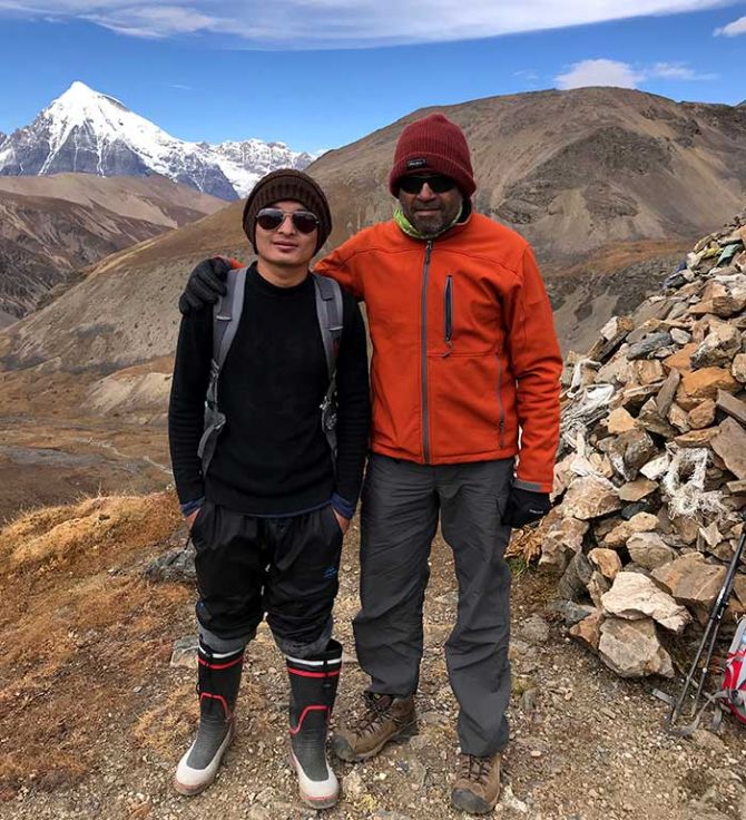
Guru Bhoopala's seven-day trek took him to the base camp of Jomolhari, a majestic 7,500 metre mountain, unclimbed and revered by the Bhutanese. He returned with a rich story to tell.
All photographs by Guru Bhoopala
Over the last decade or so, I trekked to multiple places across the globe, from Ladakh Pangyong Tso lake to the Everest base camp, Appalachian trail in Tennessee to Cotopaxi in Ecuador, the forests in Illinois to Torres del Paine in Chile.
My trekking group started as a band of four friends, and has grown to a group of fifteen people.
As always, this time too it was supposed to be different.
Bhutan, the land of gross national happiness, was alluring and seemingly forbidden at the same time.
The fact that we were going to be trekking in the disputed Doklam area added to the thrill and mystique.
Reaching the base camp of Jomolhari, a majestic 7,500 m mountain, unclimbed and revered by the Bhutanese, was part of our eight-day trekking plan. Hence the name 'Jomolhari trek' was given to this trekking circuit.
Sparsely populated by about 700,000 people, Bhutan is a small country nestled in the Himalayas.
The land is locked by giants -- India and China -- as Bhutan continuously strives to carve out its own identity and emphasise its distinctive Buddhist culture of inclusiveness, happiness, peace and conservation of nature. Bhutan constitutionally mandates two thirds of the country to be covered by forests.
They have created genuine green corridors linking the forests in various parts of the country, so that wildlife can freely move around.
Bhutan controls the influx of enthusiastic holidayers and trekkers by imposing a mandatory per day price -- which is bit steep by the standards of the region - and ensuring that only the Royal Bhutan Airlines flies into their country.
We entered this mystical land in the third week of October, flying from Kolkata into Paro, Bhutan's only international airport.
Landing into Paro, we could immediately notice the distinctive architecture of their buildings. The windows, which held the pride of place, were elaborately decorated with motifs resembling royal homes and the Bhutanese way of life.
Almost all houses and offices were prominently adorned with well-decorated images of phallus -- these images are most visible in the facade of the homes and offices.
The Bhutanese people believe that the image of the phallus wards off evil and brings in good luck.
On their roads, the absence of any kind of two or three wheelers was striking. Almost all the vehicles are cars and this did give a sense of order on the roads.
The fact that there are no traffic lights in Bhutan adds to the sense of orderliness and calmness of the place.
We started our trek with the customary and most popular hike to Tiger's Nest, perched atop a 3,300 m mountain.
It is a fully functioning monastery founded by Guru Rinpoche, who flew in from Tibet on the back of a tigress, which was the manifestation of his divine consort. Hence the name Tiger's Nest.
This was almost a day's hike. Hiking through thick fir forests took us around four hours to reach the monastery.
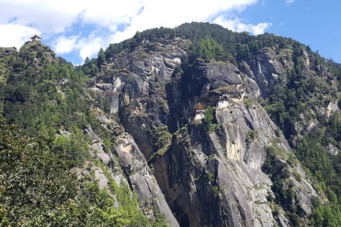
Most of the travelers to Bhutan come with an objective of hiking to the Tiger's Nest, and end up taking a horse to go up and walk down.
For our group, it was a dry run, as the actual Jomolhari trek was supposed to start the next day on October 16.
The Jomolhari trek is usually a 10-day trek with a couple days given for acclimatisation and some rest in between. We had crunched it into a seven-day trek with one altitude acclimatisation day thrown in.
It only meant that we will trek longer each day and sleep at higher altitudes without much acclimatisation. Our guide had agreed to this itinerary based on our past trekking experience and thereby our ability to handle high altitudes.
Beyond 3,500 m the altitude air get increasingly thinner and neglecting altitude sickness symptoms can lead to lethal consequences.
It was important to respect the mountains and the altitude, take it easy, acclimatise, listen to what your body is saying and heed to your guide's directions.
October 16
The first day of trek, we started with a group of 11 crew members, including guides, cooks, helpers and horsemen. We had about 24 horses to carry our supplies, luggage, food and tents.
The trek needed us to walk about 22 km in extremely muddy and rocky terrain in thick forests.
We started late that day around 10 am, which meant we would be reaching Thanghthangkha camp at an altitude of 3,594 m late in the evening around 6 pm.
Yes, 6 pm is late in the evening in the mountains!
For the next six nights, we had to sleep in tents, which was an adventure by itself.
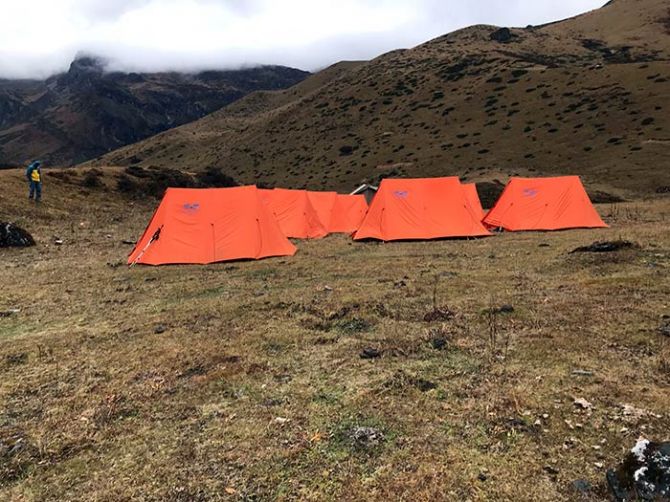
In the pitch dark, with only a dim headlamp for light, setting one's bed, getting into it and getting out of it, itself is a chore.
However, after an arduous 10 hour walk, and a meal of hot red rice and dal, getting into a sleeping bag and slumbering off was a luxury in itself.
October 17
It was a relatively easy day with only 15 km of walking and not gaining any significant altitude, to reach Jomolhari.
We were happy as we could truly enjoy the broad vistas, rugged terrain and beautiful scenery all around.
We reached Jomolhari base camp around 3 pm that afternoon. Jomolhari base is camp is arguably the best campsite I have camped in my entire career and it easily beats the Everest base camp in its location and beauty.
The Jomolhari mountain is the focal point of this campground at around 4,100 m altitude.
From the campsite, we could devour the view of Jomolhari, snow-clad, shining resplendently in the sun, jutting into the sky defiantly as if challenging the elements of sky and wind.
It was a sight to behold.
We spent the rest of the day sitting on our camp chairs, drinking hot water and just looking at the mountain.
As we crossed 4000 m altitude, we noticed that we had passed the tree line and there were no trees and no vegetation anymore.
October 18
It was altitude acclimatisation day for us. It meant we stay at the same campsite, trek to twin lakes about 8 km away and come back to the same Jomolhari base camp.
October 19
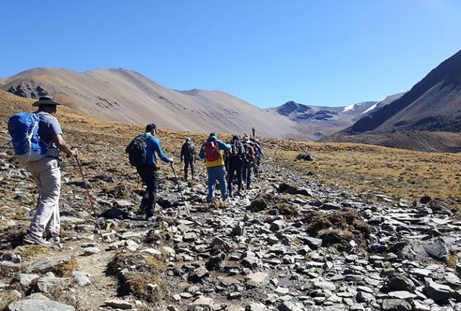
This was first of the two most arduous days of trekking where we crossed a high altitude mountain pass on each of these days. We trekked through barren mountain land of vast vistas for about five hours reaching Nyile La Pass at an altitude of 4,890 m.
Trekking at this altitude was very tough as the air is very thin. We needed to pause to catch our breath every few steps and had to be conscious about keeping ourselves hydrated.
Once we reached the pass, the breathtaking views of the mountains -- Jomolhari, Jichudraki and TsherimGang -- turned our exhaustion into exhilaration.
We trekked down for another four hours to reach our campsite at an altitude of 4,100 m.
October 20
To cross the Yalila Pass at 4,930 m altitude, we had to trek for about 18 km for about 9 hours.
This was a somewhat cloudy day, making it chilly and the altitude gain was steep -- every step was causing breathlessness and taking a toll on our bodies.
We reached the pass around 1 pm and it looked as if we were on the top of the world. We felt as though we could touch the clouds and the sky.
October 21
It was raining as we started the trek. This was perhaps the most scenic day of the trek.
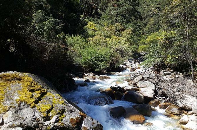
We descended into the tree line and were greeted by verdant and extremely lush green rhododendron forests with numerous waterfalls and breathtaking scenery.
We could literally smell the forest in all its freshness and that was a unique feeling.
This day also turned out to be the longest day of trek with 25 km trekked and covered in about 12 hours.
October 22
Our last day of the trek. We had one steep hike before we came down and started walking on roads under construction by the government in the border area.
The sight of SUVs waiting for us at the end of our trek was such a welcome sight.
We saw and sat in a motorised vehicle for the first time in a week.
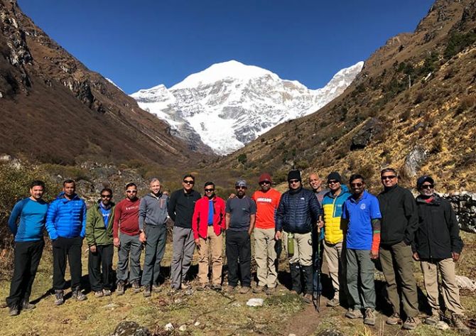
The drive to Thimpu took us couple of hours and at the hotel, we had the first opportunity in eight days to take a hot shower and clean up.
Several people ask us why we do these treks that stress out our bodies, and live like nomads with minimal stuff.
My response has always been the same.
It provides me a sense of satisfaction to push the limits, expand the zone of comfort and it gives me a sense of accomplishment.
It also makes me grounded, calm and spiritual. It's time you Go find your own adventure.
The author lives in Chicago, USA, and is an IIM-B alumnus. He is an avid trekker and blogger.




 © 2024 Rediff.com -